
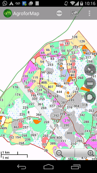
GPS Navigator with custom maps agro forestry
Application Features:
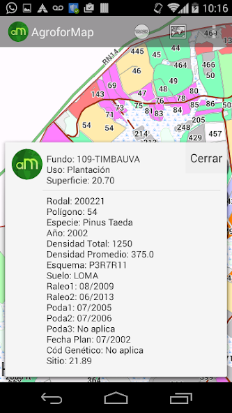
- The data for each field of each planting within reach of a click on the screen;
- Quick consultations on the situation of each plantation: performance, applications, management executed, previous crop, so planting, planting date, soil, etc. (The variables are unique to each client);
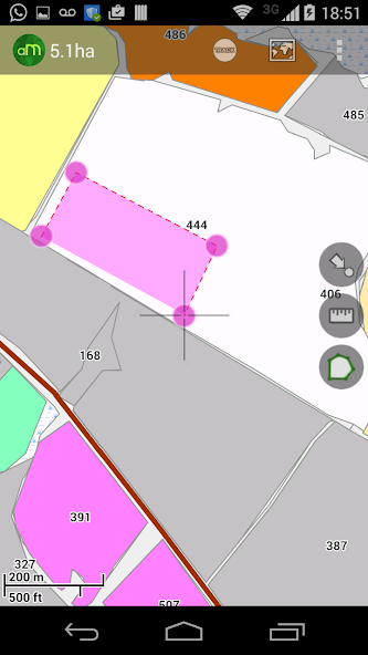
- Function for calculating areas and measures distances;
- Function "My position" that allows the user to accompany the device location;
- Photos, screenshots, multi schemes maps, recording routes;
- Easy and quick handling of the application allows the user to practical experience;
- Enables offline access to all the maps and database clients;
- Without the need for field maps and spreadsheets, application activities and optimizes operator time;
- Your company with much greater speed and agility in agroforestry.
 Download(15.1MB)